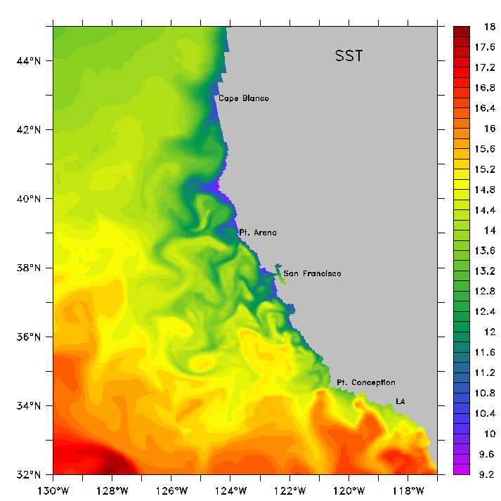
Snapshot from the embedded 15+5km simulation with the NPDZ biogeochemical model in its US West Coast configuration, representing June 15 of the first modeled year (climatological forcing was used in this simulation). The above field represents the surface layer, SST is in C. (Gruber et al., 2004a)