Limitations » Viewing Angle
Viewing angle can also be an issue for targets far from the radar, depending on the type of precipitation and atmospheric conditions present. Convection can generally be viewed at some elevation by the radar except when a storm is very close —within the cone of silence. Even then, the storm's low levels, where strong rotation and other hazards can still be detected, are somewhat observable. When precipitation is far away from the radar, even the lowest angle beam may overshoot important features. These types of problems become more pronounced for low-lying precipitation, as small areas close to the radar can be completely missed.
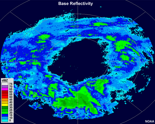
Here is an example in which none of the precipitation falling from a low, layered cloud reaches the ground. A donut shape appears on the radar return as the pulses do not encounter precipitation until they reach the cloud itself, pass through the precipitation, and then exit into the non-precipitating sky above.
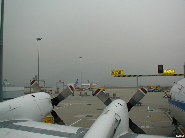
Most of the time, fog goes undetected by radar because of its very low altitude and the small droplet sizes. But it may show up on radar in some cases where there is a thick layer of very dense fog and the radar beams bend toward the ground.
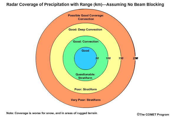
This graphic summarizes how well a NEXRAD WSR-88D radar can capture convective precipitation from tall clouds and stratiform precipitation from low, layered clouds.
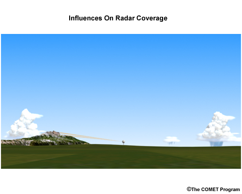
Another problem with radar viewing angles is that of physical obstructions. It is sometimes unavoidable to site radars such that their low angle beams will not intercept the local topography.
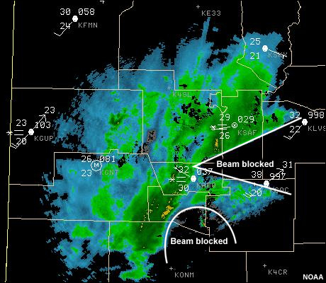
When this occurs, it is called "beam blocking," and low-angle beams will sometimes have a very short range. In cases of high mountains, many of the beams may be blocked.