Supercell Thunderstorms
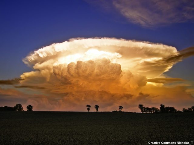
Supercell thunderstorms produce some of the most violent weather on earth. They are a unique form of single-celled convection that is defined by a rotating updraft.
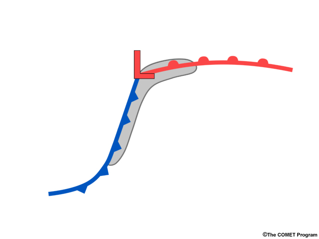
Supercell thunderstorms usually develop just ahead of cold fronts and along the warm front close the center of low pressure.
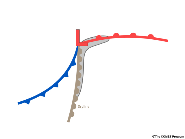
They can also form along drylines. They typically last several hours, are prolific producers of large hail and tornadoes, and occasionally, damaging straight-line winds.
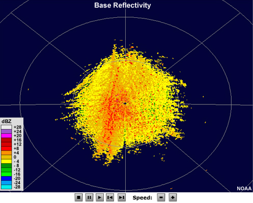
Supercells usually consist of a single cell of intense convection, usually about 30-60 km (20 to 40 mi) across the widest portion of the storm on radar. There are two hallmark signatures that characterize most supercell thunderstorms:
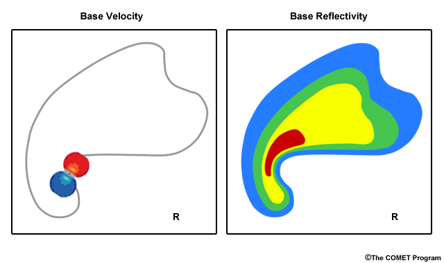
- A mesocyclone, which is a rotating updraft that displays as a rotational couplet and
- A hook echo, which is created by precipitation echoes wrapping around the mesocyclone.
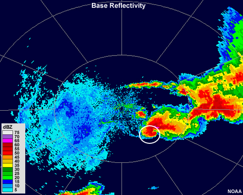
Reflectivity
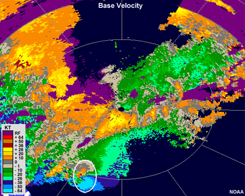
Velocity
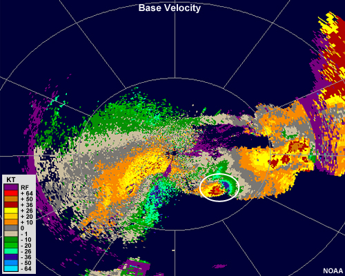
In this example, the hook echo is rather broad, and the mesocyclone couplet is clear.
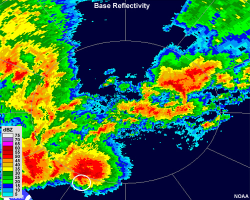
Reflectivity
Velocity
This hook echo is rather narrow and does not curve as much as a typical hook echo. Sometimes, hooks that look more like small appendages sticking out from the main convective core are referred to as "pendant" echoes. The mesocyclone couplet in this case is easy to discern and contains a significant amount of convergence as well.
Rotational signatures such as these may occur within some cells that comprise lines of convection, such as those that make up the leading portions of squall lines and some mesoscale convective systems. There, the rotation is usually smaller and weaker.
To summarize, supercells usually possess the following characteristics:
- Long-lived, lasting several hours
- Consist of a large, single cell of very strong convection that has a characteristic hook shape on radar reflectivity
- Have a rotating updraft that manifests as a rotational couplet on radial velocity