Overview of Weather Radars
A weather radar works by emitting pulses of electromagnetic energy at microwave frequencies into the atmosphere. When these pulses encounter objects, some of the electromagnetic energy is scattered back toward the radar. This is often referred to as being "reflected" back, and is where the term "reflectivity" comes from. Reflectivity is a measure of a radar target's efficiency in intercepting and returning the radar's energy and depends on the physical parameters of the target—its size, shape, orientation, composition, etc.
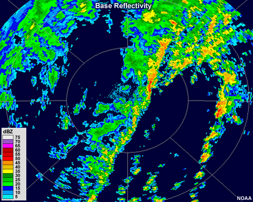
The energy received back to the radar is analyzed by computers to determine the location and intensity of precipitation, and information about the wind speed and direction. The information is then plotted on images.
In order to make the best use of radar products, it is important to understand fundamental operating principles of common weather radars, which are covered in this chapter. This information will enable a forecaster to forecast short-term precipitation trends, general wind patterns, and hazardous conditions. Additionally, forecasters will be able to recognize false radar echoes and other problems with radar images, which are discussed in the next chapter.