Convection » Hail

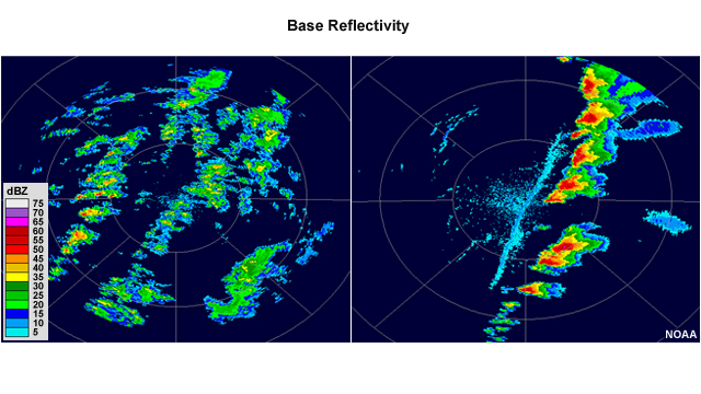
Generally, the higher the reflectivity value found in a convective cell, the stronger the thunderstorm, and reflectivity values above about 60 dBZ usually indicate hail. Thus, a few of the storms in the left image may contain small hail, while nearly all of the storms in the right image probably contain hail, some of which is likely quite large. Keep in mind that any hail present in a sample volume may decrease in size via melting or sublimation during its descent, and that there is not a direct relationship between hail size and reflectivity value. Supporting information, such as the location of the freezing level and local spotter observations, can help determine what size hail is actually reaching the ground.

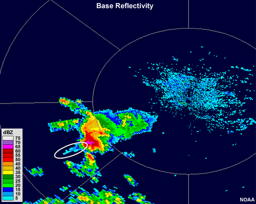
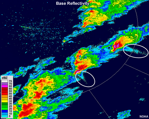
A particular signature to note for the presence of hail is called the Three Body Scatter Spike, or TBSS. A TBSS generally appears as a 10-30 km long (6-20 mi), low reflectivity (< 20 dBZ), mid-level echo "spike" that extends outward along a radar beam from a high reflectivity core. This echo spike is an artifact, formed when portions of the radar pulses are scattered to the ground and then reflected off the ground and back into the hail core, where they are interpreted by the radar as being from a location farther away.

A TBSS is a nearly certain indicator of large hail, as it generally occurs when the target size is close to the same as the wavelength of the radar pulse. It typically only occurs within the strong convection found in supercell thunderstorms.