Produced by The COMET® Program
Doppler Velocity Measurements » Large-Scale Wind Interpretation » Maxima in Speed
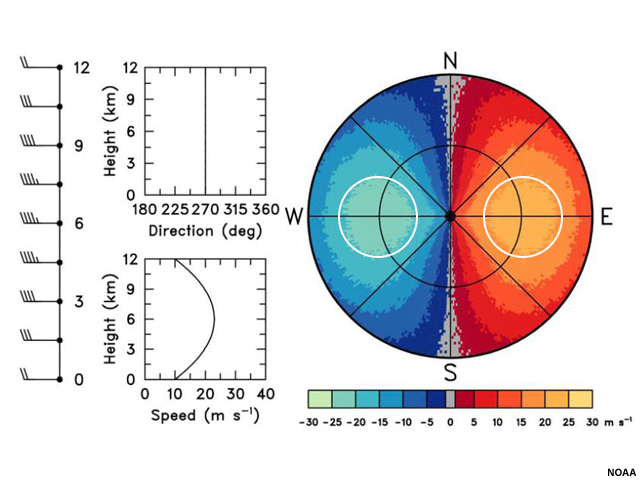
Wind speed generally tends to increase with height, but may not do so evenly. Sometimes, the polar jet stream will be sampled by radar, especially in winter, and low-level jets are routinely observed. In this idealized radial velocity image, the radial velocities show a maxima at the first range ring and above that wind speeds begin to decrease. This type of phenomena will typically show up on radial velocity images as two bull's-eyes that have closed isodops in some portion of the image.
© Copyright 2012-2017, The University Corporation for Atmospheric Research.
All Rights Reserved. Legal Notices.