Produced by The COMET® Program
Convection » Low-level Reflectivity Gradient
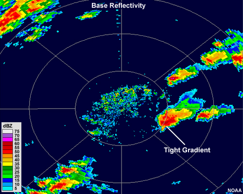
Most thunderstorm cells will have a central region, or core that exhibits strong reflectivity values. This core will usually be surrounded by lower reflectivity values. Tighter gradients of reflectivity between the edge of the cell and the core usually indicate a stronger storm.
The presence of a tight gradient indicates that large hail and/or heavy rainfall is sharply separated from the low-level updraft, which is the energy source of the storm.
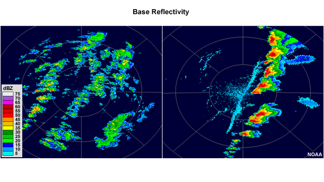
For example, the lines of thunderstorms in the left panel are not as strong as the line of thunderstorms in the right panel, where we can see a very sharp change from almost no radar return to over 60 dBZ in the cores in some of the larger cells.
A forecaster can use this information as a guideline of general storm strength when initially assessing a storm situation.
© Copyright 2012-2017, The University Corporation for Atmospheric Research.
All Rights Reserved. Legal Notices.