Common Clear Air Phenomena » Meteorological Returns » Fronts and Other Boundaries Question
What type of front or boundary do you think we are seeing in these animations? (Choose the best answer.)
The correct answer is e.
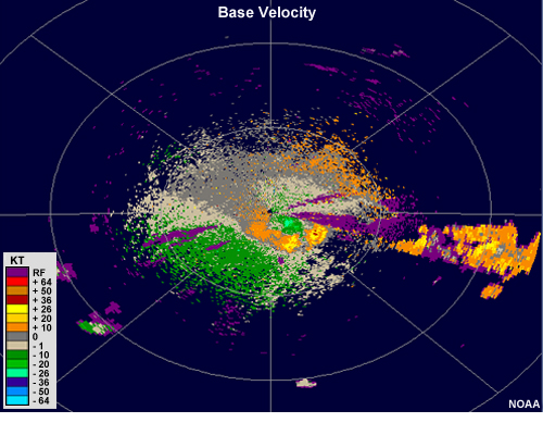
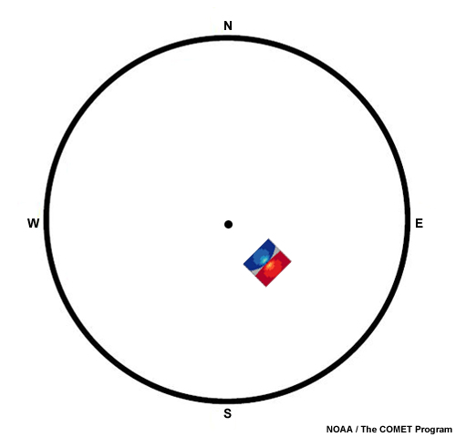
This is a textbook example of an outflow boundary. We can see a very distinct ring of enhanced reflectivity emanating away from a cluster of thunderstorms just to the southeast of the radar. Additionally, we can see a signature of strong divergence in the location of the cluster of thunderstorms at the beginning of the animation (toggle below to see the couplet in a velocity image and an idealized representation).