Convection » Thunderstorm Structures » Mesoscale Convective Systems
Mesoscale Convective Systems (or MCSs) are long-lived, organized systems that primarily occur during the warm season in mid-latitudes and the tropics. They often develop near warm and stationary fronts during the overnight hours in mid-latitudes, or in association with monsoonal circulations, easterly waves, and the ITCZ in the tropics.
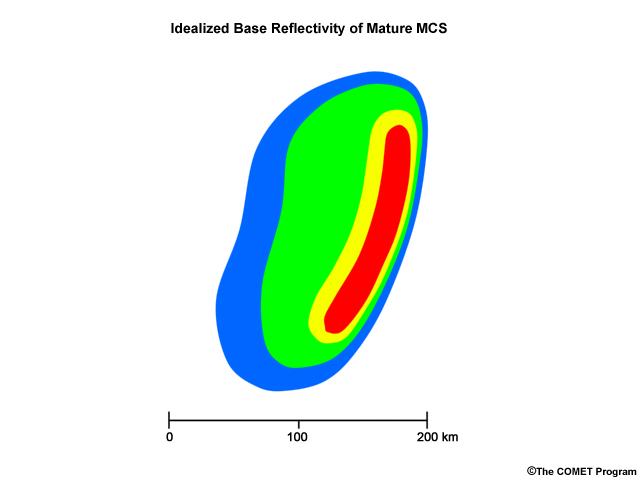
MCSs commonly consist of a leading convective line, followed by a more expansive region of less intense and widespread precipitation. In some cases, a zone of weaker reflectivity will exist between the two areas.
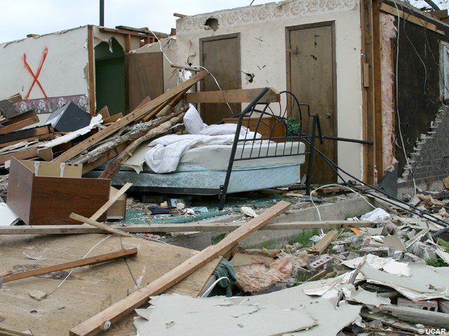
Because of their large size and longevity, MCSs provide much of the summertime rainfall to the Great Plains and Midwest. They also generate a significant proportion of damaging wind events in the U.S. each year.
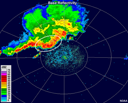
One of the most prominent features of many MCSs is the bow echo, which refers to a portion of a high reflectivity area that "bows " out ahead of the rest of the storm. Bowing is usually caused by a strong localized downdraft or sometimes a more organized, system-wide channel of air that flows from the back of the storm toward the front. These forces essentially "push" the leading convection ahead of the rest of the storm, forming a bowed segment.
In this loop, we can see how the bow develops quite rapidly.
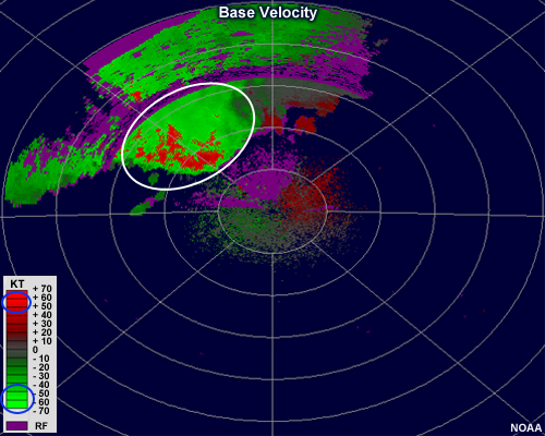
Associated velocity images usually show very high radial velocities in the direction of motion of the bow. In this case, the velocities are so high that they exceeded the maximum unambiguous velocity and are aliased to be outbound rather than inbound. It is in this region of the MCS that damaging winds most commonly reach the surface.
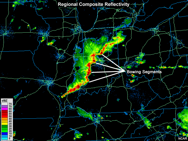
Bow echoes may also occur on smaller scales, and several may develop adjacent to each other within a single line of convection.
Bowing segments may also be found within more ordinary lines of convection and in association with some supercells. Forecasters should pay special attention to MCSs and other segments of storms that exhibit any bow echo characteristics.
To summarize, MCSs often possess the following characteristics:
- Long-lived, usually several hours or more
- Often consist of a leading line of strong convection and a trailing region of widespread, moderate precipitation
- May contain bow-shaped segments of intense precipitation within the leading convection
- May also contain damaging straight-line winds, especially just behind a bow echo, if it is present
To find out more about MCSs and their other associated radar signatures, please visit these other modules by COMET: