Weather Radar Fundamentals


Winter Weather

National Reflectivity Image showing a mass of moderate to light precipitation over Missouri and Illinois.  A wide swath of moderate to light intensity precipitation extends east-northeastward to New York, while a narrower band of more intense precipitation extends southward through Alabama
National Reflectivity Image showing a mass of moderate to light precipitation over Oklahoma.  A wide swath of moderate to light intensity precipitation extends eastward to through Arkansas, Tennessee and into the Carolinas.  A broad band of more intense precipitation extends southward through Alabama and Mississippi.

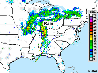
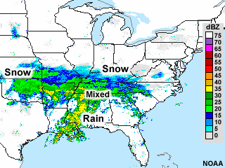
One of these mid-latitude cyclones produced rain, snow, and mixed precipitation. The other produced only rain. It can be difficult to tell using WSR-88D weather radar alone. This chapter discusses some general guidelines for estimating ice-phase precipitation versus liquid precipitation using radar.