Overview of Weather Radars » Reflectivity Products
The most common type of radar product is called "base reflectivity." It is constructed by assigning a magnitude related to the amount of scattering that occurs from a target. In this image, the reflectivity in the center is "ground clutter"—energy received from objects near the ground such as trees, buildings, or particulate matter in the air. The band of high reflectivity north of the ground clutter represents the precipitation intensity. The position of the precipitation is determined from two factors:
- Elevation angle of the antenna (how high the radar beam is pointing)
- Time it takes for the electromagnetic pulse to return to the radar
When looped together, these images give important information about the motion of precipitating regions.
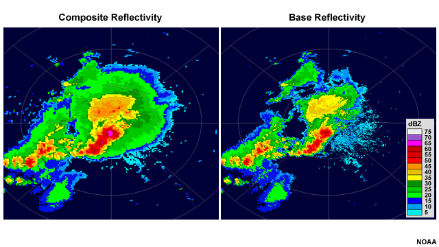
Another common display is "composite reflectivity," which shows the maximum dBZ in a given vertical column for all columns in the radar's range. Consequently, it gives a plan view of the most intense portions of a precipitating system regardless of its altitude. Composite reflectivity is very useful for noting heavy precipitation cores at mid-levels and for viewing the areal extent of precipitation at middle and upper levels. However, some of this precipitation may evaporate before it reaches the ground. To correctly use composite reflectivity you need to understand weather radar scanning geometry and also the typical structure of the observed phenomenon.