Limitations » Resolution

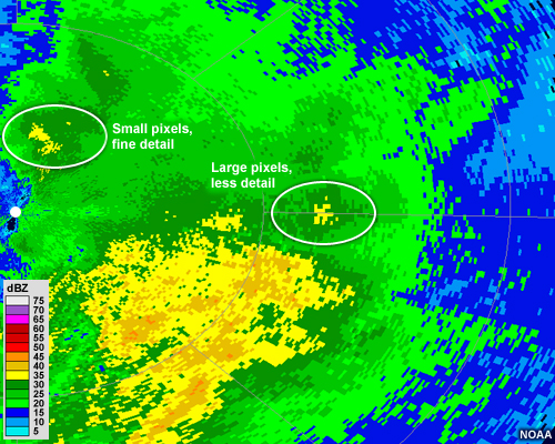
Because of the geometry of the radar beam, radar imagery inherently contains areas of varying resolution, which depends on the distance from the radar. Radar pulses broaden as they travel away from their source, creating ever larger sample volumes over which the reflectivity and other calculations are performed. This is evident in any radar image, as you can easily notice the relative small size of the pixels near the radar location and the larger size of the ones near the edge of the radar's range.

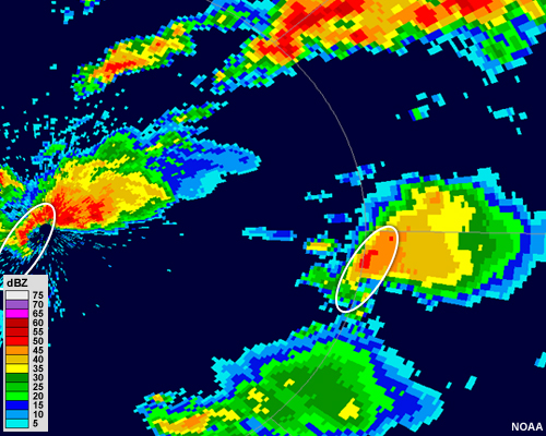
This poses some limitations when examining weather phenomena that are far away from the radar. Small but important features may not be observable as they will be averaged over an area that is larger than they are. For example, the thunderstorm nearest the radar (on the left of the image) is captured in great detail, especially its hook echo. The storm to the right looks similar, but the larger pixels don't allow us to pinpoint features as well as we can with the closer storm.